
The Yellowstone River is the longest river in Montana and one of the longest free-flowing rivers in the United States. Throughout its entire length from its beginning in Yellowstone National Park to its confluence with the Missouri River in North Dakota, the river is free of any major dams, although a couple of diversion dams do exist.
This section of Big Sky Fishing covers the Yellowstone River that runs between the Yellowstone National Park border to the city of Billings. For those seeking information about the Yellowstone River in Yellowstone National Park, please visit our Yellowstone River in Yellowstone National Park section. Additionally, for anglers looking to test their mettle on the various warm water species found on the Yellowstone River in the eastern part of the state (downstream from Billings), please visit the Lower Yellowstone River section.
Article Contents
- General Overview of the River & Fishing Information
- Detailed Fly Fishing Information for the Yellowstone River, broken into four further segments.
- Fly Fishing – Gardiner to Carbella Fishing Access Site
- Fly Fishing – Carbella Fishing Access Site to Livingston
- Fly Fishing – Livingston to Big Timber
- Fly Fishing – Big Timber to Billings
- Floating & Paddling Information for the Yellowstone River
Related Articles
General Yellowstone River Information
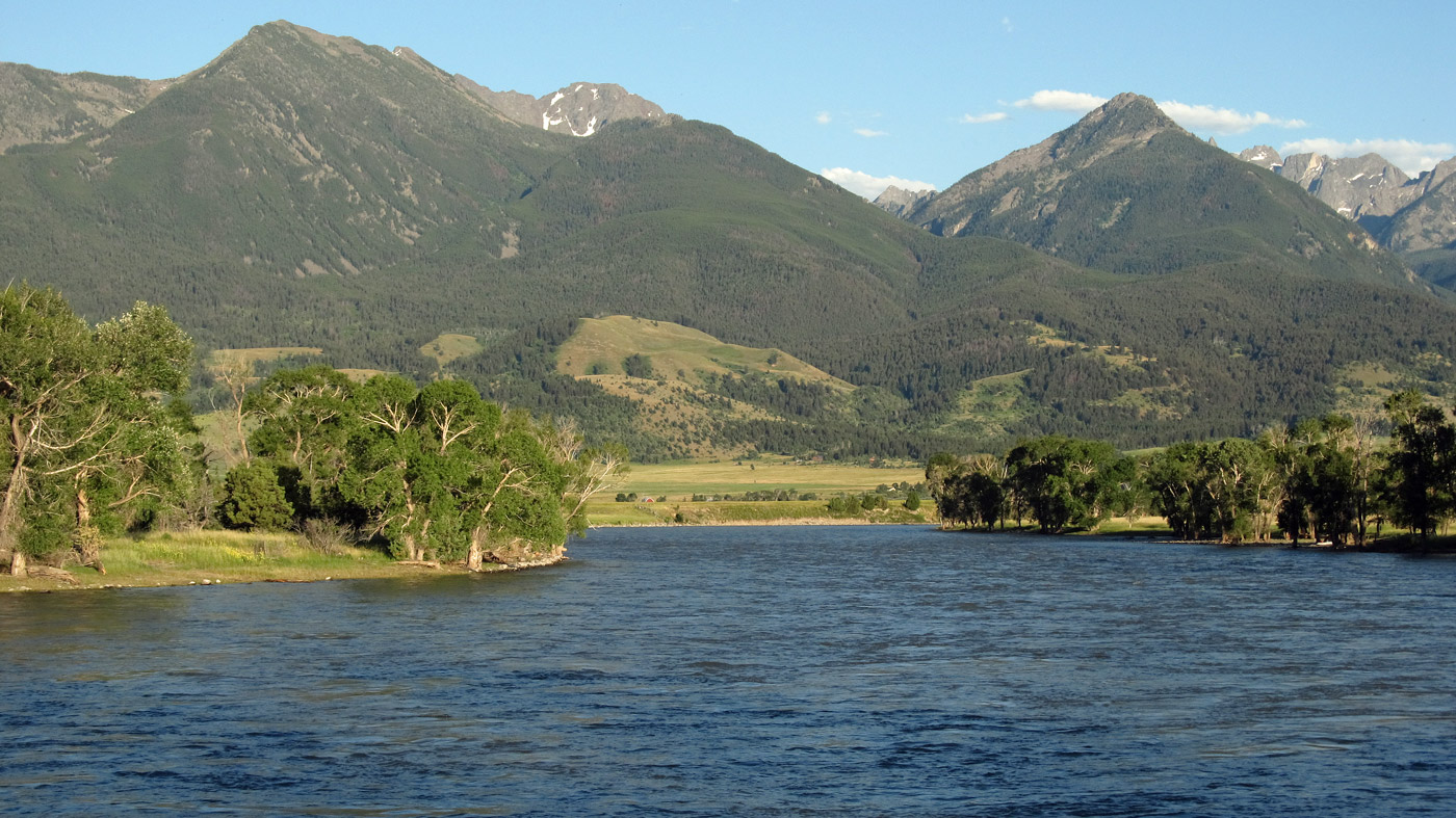
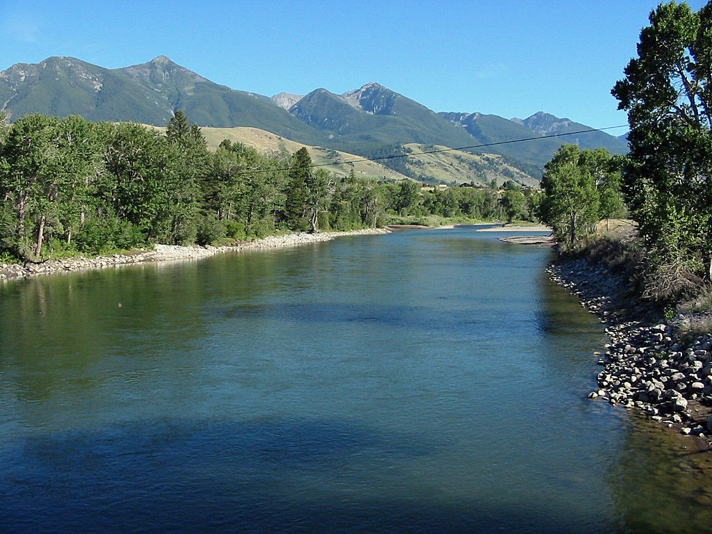
The Yellowstone River begins at Yellowstone Lake in Yellowstone National Park. It leaves the park near Gardiner and then flows north. Downstream from Gardiner, the Yellowstone flows through a scenic canyon before it enters Yankee Jim Canyon, a popular spot for whitewater kayakers and float parties. Once the river passes through Yankee Jim Canyon, the Yellowstone River spills out into the broad and very beautiful Paradise Valley.
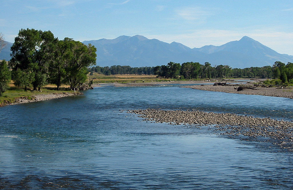
The river leaves the Paradise Valley in Livingston and then turns in an easterly direction, where it begins to meander through the plains and foothills that lie to the north of the Absaroka-Beartooth Mountains.
Between Livingston and Big Timber, the Crazy Mountains and the Absaroka Mountains are all visible in the distance. The combination of distant mountains, cottonwood trees and the high plains combine for a unique and scenic float trip.
Beyond Columbus, the mountains start to fade in the distance as the Yellowstone River passes through the prairie, often flanked by small cliffs and forested hills.
Access to the Yellowstone River is excellent. Montana Fish, Wildlife & Parks maintains an extensive number of fishing access points scattered along the river. Once water levels drop in the summer, it is usually quite easy to walk along exposed graveled riverbank. Since the Yellowstone River has unregulated flows, the river also has a significant area that lies below the “high-water mark.” This, combined with Montana’s Stream Access Law, allows for easy shore-side access and also provides abundant camping options for float parties out on multi-night trips.
Fishing Summary
Fly fishing and floating pressure is often heavy on the Yellowstone River. The floating and fly fishing pressure is heaviest between Gardiner and Livingston. Downstream from Livingston, the pressure on the river lessens significantly and below Columbus it nearly disappears. For anglers and floaters looking for solitude, consider fishing or floating the river below Livingston, Big Timber or Columbus.
The quality of the fly fishing on the Yellowstone River is excellent. Not by accident the Yellowstone River is internationally known as one of the premiere trout waters in the United States. Cutthroat trout, rainbow trout, large whitefish and brown trout are all found in abundant numbers in the upper half of the river, while the lower half (below Billings) turns primarily into a warm water fishery of large walleye, catfish and sturgeon.
The Yellowstone River is a river that is generally best fished from a boat. While fishing from shore is popular and effective, fishing from a boat provides several distinct advantages on the Yellowstone. The river is generally wide, and in its upper section, flows very quickly. Moreover, parts of the Yellowstone are surprisingly deep. The combination of width and, often, depth, limit the ability of wade anglers to cross the river to reach productive fishing spots.
While fly fishing pressure and floating is heavy on the Yellowstone, it is not completely over-run with anglers and floaters like some Montana rivers occasionally are. This is because the long length of the Yellowstone River, combined with numerous access sites, helps spread anglers and floaters around. Quality trout fishing exists on the Yellowstone River for more than 300 miles, providing lots of water for anglers to choose from.
Detailed Fly Fishing Information for the Yellowstone River
The Yellowstone River in Montana is superb river for any anglers venturing to Montana to fly fish for trout. Besides being home to large brown, cutthroat and rainbow trout, the Yellowstone River itself has such a wide variety of habitat that it offers excellent dry fly fishing as well as sub-surface fishing with nymphs and streamers.
Due to the Yellowstone Rivers length in Montana and the fact that quality trout fishing is found from Billings upstream to Yellowstone National Park, most anglers struggle not with the fly fishing but with attempting to decide where to begin. Since the river is quite long, it is best to focus in on a particular stretch of the river instead of driving back and forth hundreds of miles attempting to fish a couple stretches of the Yellowstone River.
Additionally, the scenery in the Yellowstone River country is beautiful and quite varied, so don’t be bashful about letting it influence where you fish. After all, the landscape is part of the experience of any Montana fly fishing trip.
Gardiner to Carbella Access Site
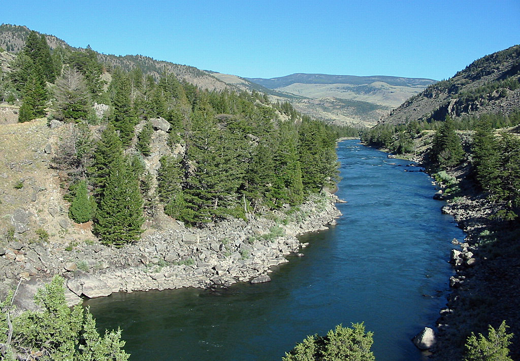
This section of the Yellowstone River flows between Gardiner, which is at the border of Yellowstone National Park, downstream to the end of Yankee Jim Canyon, marked by the Carbella Access Site. Cutthroat and rainbow trout fishing dominate on this stretch.
 Before spring run-off occurs in mid-May, which turns the Yellowstone River into a muddy mess, excellent fishing happens using small nymphs such as the Hare’s Ear and Pheasant Tail, weighed down to get the nymphs down deep in the quick current. Additionally, large streamers and stoneflies, such as Montana Stones, also work well when fished in deeper water along the bank.
A strong Salmon Fly and Golden Stone hatch occurs every year beginning in late May and lasting until early July. However, the hatch frequently coincides with spring run-off, turning the water muddy and murky, greatly reducing the effectiveness of dry fly fishing the Yellowstone River.
To take advantage of these late-spring and early-summer hatches, nymph fishing is the technique of choice. The nymph should be large (sizes 4-8), and should be floated in the slower sections of the Yellowstone River or right along the bank. As the water is murky, darker colors work best.
The Yellowstone River generally begins to clear in late June or early July during normal water years, coinciding with sporadic caddis fly hatches. Popular dry flies such as the Elk Hair Caddis, although selecting larger flies will catch the larger fish and reduce the number of whitefish brought to the net. Compared to the other rivers in Montana, the caddis fly hatches that occur on this stretch of the Yellowstone River during the summer are not extensive.
Beginning in late July, and continuing for the rest of the summer, hopper fishing is excellent. Use large hoppers, sized 4-8, floating them right along the banks. Additionally, anglers can use streamers like the Marabou Muddler, fishing them in the deep holes and around the larger rocks.
Read the web’s best guide on how to select a fly rod to meet your own specific fishing needs.
Carbella Access Site to Livingston
This section of the Yellowstone River, which flows through the beautiful Paradise Valley, has the most fishing pressure. Besides offering solid trout fishing, anglers are awarded with scenic vistas of the towering peaks of the Absaroka Mountains to the east and the Gallatin Range on the west.
 This section of the Yellowstone River is home to a solid mix of large brown trout, cutthroat and rainbow trout are found. The diversity provides anglers with a wide variety of fly fishing possibilities and also allows for flexibility.
As in the upper section, the Yellowstone River is typically swollen and muddy due to spring run-off from mid May to early July, limiting top water fishing. However, for those times when the river runs clear due to either cold weather or a limited snow pack, excellent dry fly fishing happens using standard Caddis flies, such as the Elk Hair Caddis. When going after rainbow trout, locate the edges of slow and fast current, floating the fly right along the seam. Brown trout can also be taken by floating the fly right along the rivers edge and around obstructions in the river, such as rocks and downed trees.
Most likely, however, early summer conditions will leave the Yellowstone River murky and muddy. When this happens, fly fishing this stretch isn’t much different than fishing further upstream discussed previously. Use large nymphs or large attractors, floating them down deep in slower current. Dark colors are once again recommended.
Later in summer, this stretch of river, as is the rest of the Yellowstone River, turns into prime hopper fishing waters. As the river flows through the Paradise Valley, the riverbanks are lined with grass and hayfields—prime hopper country. Use a larger hopper in sizes 2-10, noisily plopping them in the water and floating them right along the banks. If you’re tired of fishing hoppers, attractor flies such as Royal Wulffs also work well.
 A number of feeder creeks feed into the Yellowstone River along this section. For the angler who has a boat or is willing to walk along the riverbanks to reach these feeder creeks, fly fishing at the mouths of these creeks can provide excellent action. Many of these little creeks have their own little mayfly and caddis hatches, providing the angler with excellent fishing if you happen to be there when the hatch starts. Additionally, some of these creeks run clear when the Yellowstone River runs murky—thus opening up top water fishing when spring run-off blows out top-water fishing on the Yellowstone itself. When fly fishing at the mouths of these creeks, float a dry fly along the seams of fast and slow current, as the large trout often hold there.
Finally, as the Yellowstone River nears Livingston, a number of braids and channels are located in the river. Don’t ignore these channels, as they often hold large fish. Additionally, since most anglers do tend to ignore the side channels and braids, fishing pressure is often less. Look for braids and channels that are fairly deep with a decent current, as they are less likely to have frozen over during the winter or run dry during a previous summer of low water. While you will find trout in braids that do freeze over, you won’t find many large trout for the simple reason that food will be scarce in braids that freeze during the winter.
Livingston to Big Timber
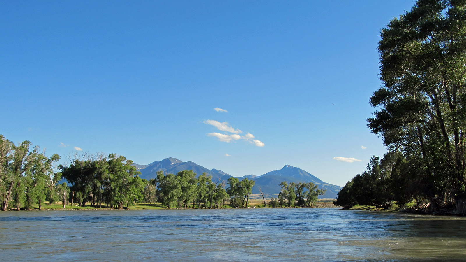
Below Livingston, fishing pressure is less than further upstream. As the Yellowstone River flows through this section, it’s no longer confined within a scenic valley. Instead, it runs through true “high plains” country, with the Absaroka Mountains now to the south and a number of other mountain ranges always visible in the distance.
 The landscape is basically devoid of trees east of Livingston, except for right along the river where cottonwood trees line the bank. The prairie that is found away from the Yellowstone River, though, is hardly flat. Instead, it is a series of rolling hills, some of which are quite large. Thus, don’t let the “prairie” setting scare you away from fishing this section of the Yellowstone River.
Although the Yellowstone River flowing through high plains and would seem to offer reduced fly fishing opportunities, an angler should not pass up the opportunity to fly fish somewhere along this section. The Yellowstone River, between its fast current and mountainous origin, tends to run cool all year long, allowing healthy trout populations to exist in places where many anglers would dismiss at first sight. Healthy populations of rainbow and brown trout are found along this stretch.
Additionally, the fish in this section of the Yellowstone River tend to be larger than further upstream. The larger fish, combined with reduced fishing pressure (the further downstream you go from Livingston, the less fishing pressure exists), can make for some wonderful fly fishing possibilities.
The Yellowstone River in this section is broad and deep. Additionally, for most of its length in this section the Yellowstone River has a moderate current (faster nearer Livingston and slower further downstream), so except during very low water years, wading can pose problems for the angler seeking the best fishing spots.
When fly fishing along this stretch of the Yellowstone, an angler has a number of strategies they can use, depending on the season.
 During the early season, excellent caddis hatches occur. Unfortunately, spring run-off frequently turns the river into a muddy mess, limiting top water fishing. When the river is clear, though, an angler should make sure that they have caddis flies for all occasions (nymphs, emergers and top water), using the appropriate fly to match the hatch. Successful fishing during this hatch requires using the right type of caddis fly to match what the trout are feeding on. Thus, if you are fly fishing an Elk Hair Caddis on top with no luck, don’t hesitate to try an emerger caddis pattern such as a X-Caddis or a nymph caddis pattern such as a Prince Nymph.
A second strategy is to fish for the large trout that lurk in the many deep holes. While dainty dry flies will occasionally work, the best bet to hook these large fish is to use large weighted streamers on sink-tip fly lines, with heavy leaders, fishing them down deep in the holes. For the angler looking to pull up a large brown or rainbow trout, this is perhaps the best method.
A glance at the country the Yellowstone River flows through, with endless vistas of hay and grass, should offer a solid clue to the third strategy that’s used later in summer. Fish hoppers right along the banks, focusing on any obstructions lying in the river or where any undercut banks happen to be found.
A fourth strategy, also for later in summer, is to match the various small hatches. Both caddis and mayfly hatches occur along this stretch. While the hatches don’t match those found on some other Montana rivers, they none-the-less provide solid fishing. While an angler is unlikely to take a very large fish this way, it does provide the top water fisherman an excellent opportunity to land decent sized rainbows with smaller flies on top.
Big Timber to Billings
This section of the Yellowstone River is the least heavily used. Floaters and wade fisherman who are willing to walk away from the access sites are quite likely to have this stretch of the Yellowstone River to themselves. The Yellowstone is wide and fairly slow, with many deep pools. The Absaroka Mountains still line the south sky line, but slowly fade into the distance as the river approaches Billings.
The best fly fishing on this stretch is on the upper half. Quality trout fishing drops the closer to Billings one gets, although brown trout are still found in decent numbers sizes.
Fishing this stretch is not much different than the stretch between Livingston and Big Timber. Use streamers and large nymphs to catch the larger fish that are found in the deep holes. And use the ever-popular hopper right along the banks.
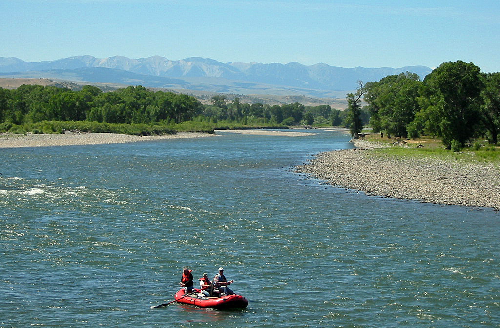
Floating & Paddling Information for the Yellowstone River
 The Yellowstone River begins in the Absaroka Mountains of Yellowstone National Park, where it soon flows into the massive and beautiful Yellowstone Lake. Beneath Yellowstone Lake, the river continues to flow through Yellowstone Park, flowing over the huge Yellowstone Falls. Beneath the falls, the river enters steep canyons and flows wildly, before entering Montana in the town of Gardiner.
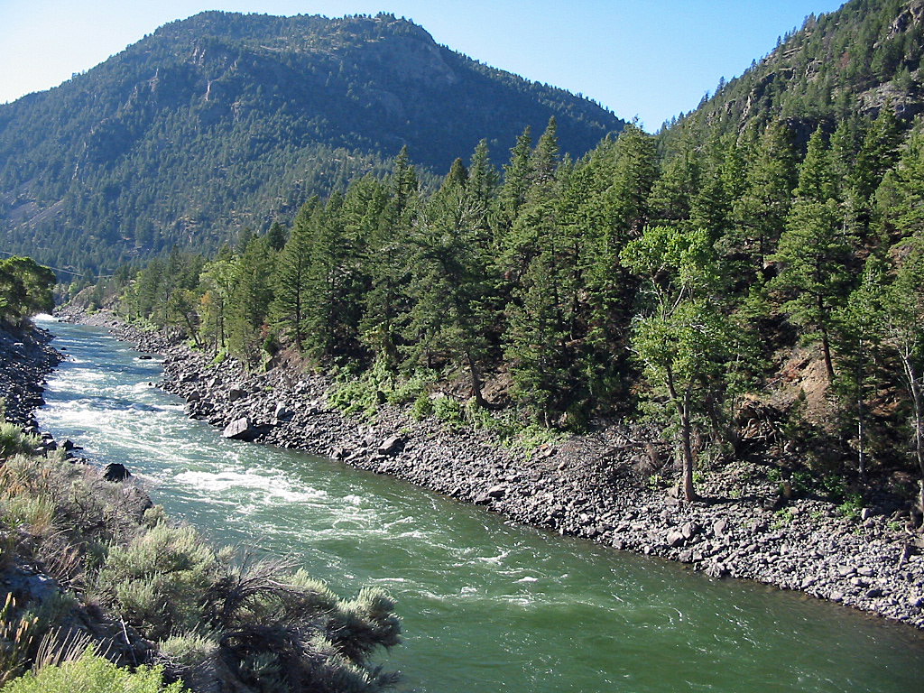
Floating is not allowed in Yellowstone Park, so floating begins in Gardiner. For most of its length, the Yellowstone River has few major rapids. The exception occurs in the upper section soon after the river leaves the park. Several Class II rapids are found downstream from Gardiner.
And beginning thirteen-miles downstream from Gardiner, just below the Joe Brown Fishing Access Site and lasting to the Carbella Access Site five miles downstream, the Yellowstone River flows through Yankee Jim Canyon. Several Class II-III rapids are located here, requiring experienced floaters in whitewater capable boats, such as drift boats, inflatable fishing rafts and expedition level inflatable kayaks. The severity of the rapids encountered in Yankee Jim Canyon depends on river levels—during high water the rapids are stronger. Usually by August river levels have fallen low enough that most of the rapids become a series of short Class II+ rapids with large waves.
Below the Carbella Access Site, the Yellowstone River flows through the very scenic Paradise Valley with no whitewater but plenty of riffles. Floating pressure is moderate to heavy between Carbella and Livingston as this stretch of river has the most fishing pressure. Several outfitters also provide recreational floating services, too.
Access to the Yellowstone River is excellent between Gardiner and Livingston. Public lands are found along many stretches of the river. Additionally, there are numerous designated fishing access sites that provide great access.
Below Livingston, floating and fishing pressure both fall. Access to the Yellowstone River, while still good, is more difficult since the river flows primarily through private lands and access sites are more widely spaced.
Except during higher water levels, this section of river is easily floated by anyone, with the strongest rapids being some shorter Class II sections.
However, while there are no major rapids between Livingston and Columbus, there are many areas that have strong riffles and small waves. These rapids can usually be avoided, except for one section directly downstream from Livingston. Only floaters in canoes will have any difficulty navigating this stretch when water levels are low to moderate—the waves, while small, can still capsize a canoe quite easily if the canoe hits the wave broadside.
Downstream from Columbus, there is one final strong rapid that ranges from Class II to a weak Class III, depending again on river levels.
Following these rapids, the Yellowstone River continues to flow through the prairie and slowly leaves the mountains behind. Although the river flows through the prairie, the float is still quite scenic, since the Absaroka-Beartooth Mountains loom to the south and the Crazy Mountains dominate the skyline to the north.
Downstream from Billings to the rivers confluence with the Missouri River in North Dakota, floaters will encounter several diversion dams that require portaging, including one in Forsyt. These dams are widely spaced apart, however, for the rest of the Yellowstone Rivers length in Montana.
Selected Yellowstone River Miles
Listed below are selected river miles for the Yellowstone River in Montana. You can get more detailed information about these access sites at the Montana FWP website.
- Gardiner (Queen of Waters Fishing Access Site): 556.9
- Corwin Springs FAS: 551.4
- Tom Miner Bridge (end of Yankee Jim Canyon): 549.7
- Slip & Slide FAS: 545.7
- Point of Rocks FAS: 536.2
- Emigrant FAS: 525
- Grey Owl FAS: 522.2
- Paradise FAS: 518.3
- Mallards Rest FAS: 511.3
- Free River FAS: 500
- Mayors Landing FAS: 494.7
- Highway 89 Bridge FAS (Livingston): 488.8
- Springdale Bride FAS: 473.5
- Otter Creek FAS (Big Timber): 454
- Bratten FAS: 434.2
- Homestead Isle FAS: 388.9
- Captain Clark FAS: 310.6
- Amelia Island FAS: 272.5
- Pirogue Island State Park: 179.9
- Elk Island FAS: 51.7
- Seven Sisters FAS: 39.5
- North Dakota Border: 0
Related Articles
- Paradise Valley Scenic Loop – Details and photographs about a gorgeous scenic drive through the Paradise Valley of Montana
- Livingston, Montana – Town info and photographs
- Big Timber, Montana – Town info and photographs
- Columbus, Montana – Town info and photographs
- Stillwater River – Detailed fishing and floating information and photographs
- Fishing the Yellowstone River in Yellowstone National Park – Fishing info and photographs
- Fishing the Lower Yellowstone River – Detailed info about fishing the Yellowstone River downstream from Billings, Montana.