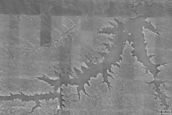
| This is an aerial photograph of Fort Peck Lake. The lake was created by the Fort Peck Dam, which is a dam on the Missouri River. The lake is over 120 miles long and 50 miles wide. As can be seen in this aerial photo, the lake has a very irregular shoreline. The dam itself is located on the upper right of the photo. The Missouri River can also be seen snaking away from the lake. |
![]() Fort
Peck Lake
Fort
Peck Lake
![]() Fort
Peck Lake & Dam
Pictures
Fort
Peck Lake & Dam
Pictures
![]() Montana
Hi-Line Maps
Montana
Hi-Line Maps
![]() Montana
Hi-Line Photo Gallery :
Main Hi-Line Photo gallery
Montana
Hi-Line Photo Gallery :
Main Hi-Line Photo gallery
![]() Montana
Hi-Line :
Return to the Hi-Line section
Montana
Hi-Line :
Return to the Hi-Line section
![]() Home
Page of Big Sky Fishing.Com
Home
Page of Big Sky Fishing.Com
![]() Photo
Use Policy
Photo
Use Policy