Travel Tips for the Montana Hi-Line
The Montana Hi-Line is characterized by open, vast and rather desolate country. Since anyone reading this section is likely to be interested in visiting the Hi-Line area at some point, I’ve decided to put in some tips that anyone visiting the Hi-Line might want to keep in mind when exploring this region.
US Highway 2
The Hi-Line in Montana is characterized by US Highway 2, which runs from the North Dakota border in the east all the way to the Idaho border in the west. The highway is predominantly flat up until it nears Browning, although it does have some hills scattered about. Additionally, although the highway has many straight sections, it has, considering the flat topography, quite a few curves in the road.
The condition of the highway is generally good. While it is a bit narrow in spots, and can get a bit busy at times in the summer, usually a visitor can make good time in a safe way when driving down US 2. Services, while not exactly abundant, are more than adequate for the traveler who is just planning to stay on the highway. The main towns to get gas, snacks and other travel things will be Wolf Point, Glasgow, Malta, Havre, Shelby and Cut Bank. While the other little towns in-between these places generally have a gas station and often times more, you can’t always count on them being open or even in business. Thus, always be safe and keep a little extra gas in your tank, being sure to gas up (if needed) when you pass through these towns.
The weather in this area of Montana is, during the summer at least, generally quite nice. It can get hot at times, but most heat waves only last a few days during a normal summer. However, come October and lasting up until April, this area gets pounded by periodic snowstorms. How much snow falls depends on the year, but when it snows in this area, due to the winds, the snow can make a voyage down the Hi-Line an interesting one. Thus, if you plan to drive the Hi-Line during the winter months, come prepared with decent tires, a full tank of gas and some warm clothes in case you end up off the road by accident. Also, stay aware of the occasional road closure.
Off Highway Travel
The vast majority of all “development” is located on Highway 2. Once a visitor leaves the highway, they enter an undeveloped country. There are very few towns of any size located to the south and especially to the north of US Highway 2. While the map may list a town here and there, do NOT assume these towns have anything besides a post office. Some might, but many others don’t. Thus, if you plan to explore, the Sweet Grass Hills, the Bears Paw Mountains, the “deserted area” between Fort Peck Lake and Malta or some of the other truly remote regions of the Hi-Line, make sure you fill up your gas tank before leaving. Take some food, water and toilet paper along, too.
Once a visitor leaves US Highway 2, most of the roads are gravel or dirt in nature. During the summer, most of these roads are usually in good shape, although they are often dusty and sometimes bumpy. However, when these roads get wet (such as due to a rainy period), these roads can turn to a slick but yet sticky type of mud that make driving a painful, slow chore. Even a good 4x4 truck can get stuck in this stuff, and a passenger car can occasionally be swallowed up whole by it. These roads are especially nasty during the spring thaw. Thus, if you don’t have a 4x4 and the roads are wet, it is generally a good idea to hold off on exploring the more remote areas of the Hi-Line until the roads dry out a bit. This usually means waiting no more than a day or so during the summer months. Remember, if you get stuck out on a back road in the Hi-Line, you may have a VERY long wait for the next car to come by. To top it off, it is quite likely your cell phone will not work, either.
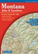
Also, and this is a MUST, if you plan on venturing off US Highway 2, be sure to have the Montana Atlas & Gazateer Book. This handy book lists all the roads in the region.
Lodging
There are hotels and motels along the Hi-Line, of course. However, there are surprisingly few chain hotels. Only in Havre will you find any big chain hotels (which has a Best Western and Super 8). Shelby and Cut Bank also have a Super 8. But between the North Dakota border and Havre, you’ll only find “mom and pa” type operated hotels. Many of these hotels are surprisingly nice and are usually quite affordable. Others, though, can be a bit on the rough side. The best hotel you’ll find between Havre and the North Dakota border is in Glasgow, called the Cottonwood Inn.
Food
I’m not exactly a connoisseur of fine restaurants. But I did eat at quite a few of them on my last trip down the Hi-Line. Unfortunately, I can report that at the ones I did eat at were nothing special. I suspect somewhere along the Hi-Line there are bound to be a few good restaurants (probably steak places), but I wasn’t able to find any.
However, while the Hi-Line may be lacking a bit in fine dining, virtually all of the little towns along the Hi-Line have a café of one type. Generally, these cafes are decent to eat at. There are also very affordable. As for fast food, you’ll find the usual suspects in Havre. Other towns on the Hi-Line, like Malta and Glasgow, generally will have one or two fast food joints but will not have the whole variety that other towns have.
Shopping
There are two “box stores” on the Montana Hi-Line, a Super K-Mart and a Walmart, both of which are located in Havre. Thus, if a traveler needs goods commonly found at a box store, be sure to pick them up in Havre.
Other than Havre, for shopping opportunities elsewhere on the Hi-Line visitors will find towns the way they use to be. Most downtown areas of the major towns have small shops selling various items. Visitors will have the best shopping luck in Havre, which has everything, while other smaller towns like Glasgow and Malta generally have all the basics – but will be lacking in specialty items.
See more pictures of Fort Peck Lake and Dam.
Next Page : Maps & Aerial Photos of the Hi-Line Region
Copyright 2002 - 2018 Big Sky Fishing.Com
|
|
|